


The story below is an excerpt from our January/February 2018 issue. For the rest of this story and more like it subscribe today, log in to read our digital edition or download our FREE iOS app. Thank you!
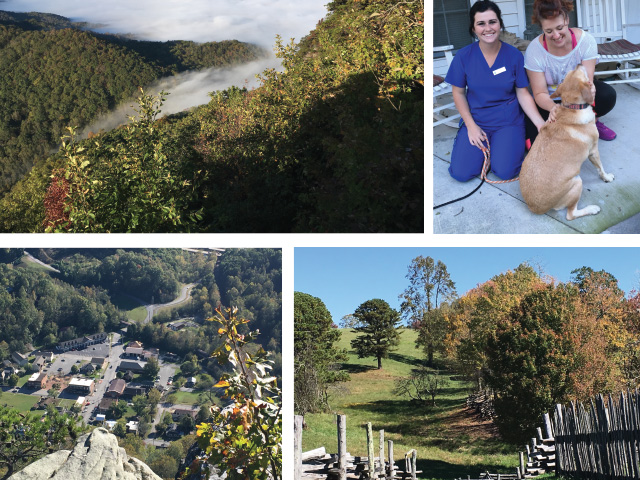
Twenty-two years after her first visit in 1995, our writer went to the Cumberland Gap to see what had changed…and what had stayed the same.
I’d like to say that I drove past the town of Cumberland Gap, Tennessee and ended up in Middlesboro, Kentucky on purpose—that the lure of the 4,600-foot Cumberland Gap Highway Tunnel was so strong that I just had to experience driving through it.

But the truth is, I missed the turn off U.S. 58 into the Gap, and kept following the rerouted U.S. Highway 25E until the twin tunnels were right in front of me. And there was no turning back.
The roads are all new around the Cumberland Gap, and the five miles of four-lane approaches to the tunnel make it difficult to end up anywhere but under Cumberland Mountain, driving beneath rock riddled with prolific springs, a lake 30 feet deep and caverns as tall as 85 feet.
After three days of re-exploring the Gap, here is what I know. The story of the Cumberland Gap—where Virginia, Tennessee, and Kentucky meet in mountainous beauty—is more than anything a story of roads, paved with get-rich-quick dreams tempered by Appalachian reality.
Cumberland Gap is one of only three natural breaks in the 1,500-mile Appalachian chain. Great herds of buffalo moved through the Gap to drink from the salt springs, and Native Americans followed them, passing into what is now Kentucky over the 1,304-foot Gap. Dr. Thomas Walker described the area in his detailed journal as he explored an 800,000-acre land grant for the Loyal Land Company in April of 1750:
We went four miles to large Creek,…and from thence Six miles to Cave gap the land being Levil. On the North side of the gap, is a large Spring, which falls very fast….On the South side is a plain Indian Road….This Gap may be seen at a considerable distance, and there is no other, that I know of, except one about two miles to the North of it, which does not appear to be so low as the other. The Mountain on the North Side of the Gap is very steep and Rocky, but on the South side it is not so.
Daunted by the rough terrain and hardships of southeastern Kentucky, Walker and his group returned to Virginia. But his description of the land, springs, and minerals lying beyond the Gap tempted landseekers rich and poor.
Which is where Daniel Boone and the Wilderness Road come into the picture.
Known as “the white man considered to have the most knowledge of the existing trails,” Boone was hired by North Carolina Judge Richard Henderson and his land speculation Transylvania Company to build a viable passage through the Cumberland Gap—The Wilderness Road. Their goal: to colonize the rich Kentucky River land and make Kentucky the 14th British Colony.
To counter hostility from the Cherokee Nation, the Transylvania Company purchased 20 million acres—half of present-day Kentucky—for a mere 10,000 pounds of goods (a treaty that was later nullified by colonial Virginia’s governor).
Boone and 35 axmen cut a 208-mile trail from Fort Chiswell, Virginia through the Cumberland Gap into Kentucky. Between 1780 and 1810 nearly 300,000 settlers—including Abraham Lincoln’s father and grandparents—crossed the Gap and moved into America’s interior. The Gateway to the West had opened.
It was called Massacre Mountain, the 3.2-mile stretch of U.S. 25E that traveled through the Gap from 1926 to 1996. At least five people a year died driving it. In a partnership between the National Park Service and the Federal Highway Administration, work began on the $280-million tunnel that would carry 18,000 cars a day beneath Cumberland Mountain rather than over it.
On the day the tunnel opened in October 1996, the overland Gap Road it replaced was closed, and the National Park service began restoring this section of the Wilderness Road to its late-18th-century appearance. Using descriptions from historic journals and maps and soil from the tunnel excavation, the six-foot dirt path that Daniel Boone forged through the wilderness was restored.


")


