 Skip to content


The South Carolina site of the Revolutionary War battle makes for an easy and informative walk.
Photo Above: The battle took place on Green River Road on a cold winter day.
Photos Courtesy of Leonard M. & Laurie Adkins.
Several months ago Laurie bought a National Park Passport book at a Blue Ridge Parkway visitor center. The idea is to get it stamped, like a travel passport, after a visit to a national park site. The thing is, Laurie is goal-oriented and decided that she and I now need to visit every one of the park service’s 419 locations. She stamped the page for the parkway and walked out of the building declaring, “The quest is on!”

On a trip through South Carolina a week later, we noticed that Cowpens National Battlefield is only a few miles off I-85.
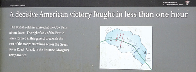
At the visitor center, park ranger William Caldwell provided some background for us: “Brigadier General Daniel Morgan’s American forces met those of British Lieutenant Colonel Banistre Tarleton’s at Cowpens on January 17, 1781. Morgan had wisely placed his forces in an open woods bordered on both sides with canebrakes (impenetrable rivercane thickets). He then split his men into three lines. Each one in succession fired at the British, who were forced by the canebrakes to face this rifle fire head on. Tarleton lost more than 800 killed, wounded or captured before he retreated.
“The battle lasted barely an hour, but it (along with the Patriot victory at nearby Kings Mountains a few months earlier) provided a morale boost for Americans that led to the British defeat at Yorktown in November.”
I imagined the sights and sounds we were experiencing on the Battlefield Trail were much the same in the morning as those of the soldiers centuries ago. The air was cool, birds were singing and dogs barked as roosters crowed in the distance.
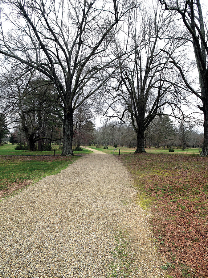
The trail follows a remaining portion of the Green River Road that the British used during the battle. Interpretive signs placed along the way describe what was happening at various times and what types of soldiers—members of the Continental Army, Colonial volunteers, Americans fighting for the English King and British dragoons and artillery men—were engaged in the fight.
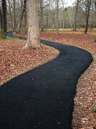
The trail turns off the road onto a pathway paved with a rubbery material, making the walking soft and spongy as it passes through a recently planted rivercane area. The hope is that it will grow into a mature stand.
During the traverse of the optional two-mile nature trail, we came across a canebrake (today a mixture of native and invasive bamboo) that vividly showed how impossible it would have been for soldiers to retreat into such a thicket. A flock of turkeys scratched the ground nearby in search of food, while we were amused by the antics of a jumping frog.
And this is why I so support the idea of national historic sites. They not only present the stories of our country, but also conserve large tracts for the natural world to survive. Cowpens has a population of the threatened dwarf-flowered heartleaf, contains more than a dozen acres of wetlands and provides habitat for gray foxes and more than 20 species of birds of conservation concern.
Back at the visitor center, Laurie demonstrably placed the Cowpens stamp in her book saying, “Two down, only 417 more to go.”
240 Years Ago
The observation of the 240th Anniversary of the Battle of Cowpens is scheduled for January 16-17, 2021. Activities include living history demonstrations, an encampment, weapons firings and lectures by Revolutionary War historians. Information may be found at nps.gov/cowp.
When You Go
Directions: Take I-85 Exit 92 at Gaffney and follow SC 11 westward for close to 10 miles; turn left into the battlefield entrance.
More information: A park map may be found on nps.gov/cowp/planyourvisit/maps.htm.
Find out more about Leonard’s walking and hiking adventures at habitualhiker.com.
The story above appears in our November / December 2020 issue.


