The bounty of trails on Roanoke’s own mountain combine with the Roanoke River Greenway and downtown to create a fine walk.
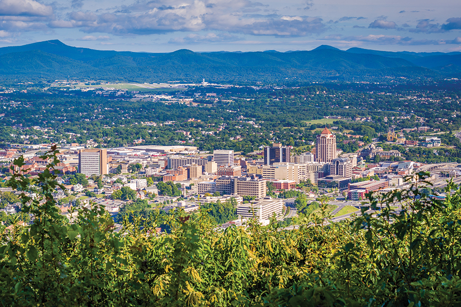
Photo Above: Downtown Roanoke, VA
Roanoke, Virginia, was continuing to create an extensive greenway system and actively rehabilitating old pathways and creating new ones on public lands when Laurie and I moved away more than a decade ago. Having recently returned to the area, I asked Kurt Rheinheimer, editor of Blue Ridge Country, to suggest a walk that would reacquaint us with the city and introduce us to some of those new outdoor opportunities.

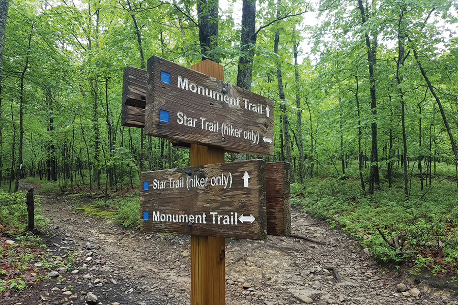
Encompassing nearly 600 acres, Mill Mountain Park has more than 10 miles of marked pathways, and our outing started with a gradual ascent on the Star Trail, whose incline and rockiness increased as elevation was gained. Benches provided a chance to relax and watch squirrels twitching tails at us as they scampered along tree trunks; half-a-dozen deer grazed in the underbrush nearby.
The world’s largest neon star sits atop the mountain. Standing nearly 90 feet tall and weighing 10,000 pounds, it was created in 1949 as a way to attract holiday shoppers to downtown. It has now become such an icon that it has given Roanoke the nickname “The Star City.” A thousand feet below, the city spreads out for miles in the vast Roanoke Valley. On the far horizon, the Appalachian Trail’s McAfee Knob looks like a wave about to break on the crest of Catawba Mountain.
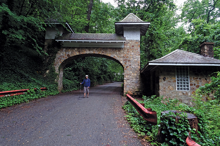
We descend the mountain on Prospect Road, built as a toll road in 1924 and now a part of the greenway system and closed to automobile traffic. The stone toll house and archway across the road remain as reminders that Mill Mountain has been a scenic attraction for decades. Now on city streets, but still traversing the side of the mountain, we passed homes with red tile roofs constructed in the early 20th century juxtaposed with our view of the copper canopy of the Wells Fargo building completed in the latter part of that century.
Crossing the Roanoke River on the Walnut Avenue Bridge, we walked into downtown on South Jefferson Street sidewalks to visit a few businesses, such as Mast General Store and the Pinball Museum (where we played a few games) that had opened since we moved away and stopped into a few others. Walkabout Outfitters and Book No Further have always been favorites through the years.
Retracing our route along South Jefferson Street, we recross the bridge and take what we feel to be a well-deserved break at Blue Cow Ice Cream Company to sample a few of their hand-crafted, small-batch flavors. I had a double portion of coffee chip while Laurie went with scoops of house made peanut brittle chocolate ganache and mint chocolate chip.
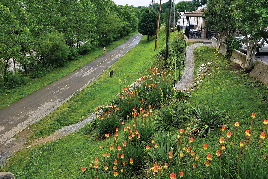
The last 1.25 miles of the walk was along the paved Roanoke River Greenway, providing a relaxing end to the outing.
Kurt—thanks for the suggestion! We had a bit of cardiovascular workout while ascending Mill Mountain through a forest populated by woodland creatures, enjoyed a far-reaching vista, learned some Mill Mountain/Roanoke history, appreciated different 20th-century architectures, patronized downtown businesses, enjoyed locally-made frozen treats and strolled beside a scenic waterway. That’s a lot of rewards for just a few hours of moderately easy walking. So much so, that we have repeated it at least once a season since then.
When You Go
The Walk: A moderately easy 5.75-mile circuit taking in Mill Mountain, downtown and the Roanoke River Greenway in Roanoke, Virginia.
Getting There: Take the Elmwood Avenue East Exit from I-581 in downtown Roanoke, drive eastward on Bullitt Ave for .4 mile, turn right onto 9th Street and continue 1 more mile. Turn left onto Riverland Road and make a right into trailhead parking in an additional .3 mile.
More Information: With a bit of searching on greenways.org, you can find maps and details about the route of this walk and other ways to build walks over and around the mountain.
Nearby Lodging
Spring Hill Suites (301 Reserve Ave. SW, 540-400-6226; marriott.com) is so centrally located that you could choose to either walk just a couple of blocks to the Roanoke River Greenway or less than a mile to the downtown area. Either choice will connect you to the described Good Walk.
Leonard has written 20 books on the outdoors and travel. Find out more at www.habitualhiker.com. He also writes Mountain Wildflowers, found on blueridgecountry.com.
The story above first appeared in our March / April 2025 issue.