The Hike: Nantahala River to Wesser Bald

Top: The view from the Wesser Bald Lookout Tower is the real payoff for the hike.

Bottom: The Nantahala Outdoor Center is hiker-friendly.

Right: The Wesser Bald Lookout Tower was originally built in 1936.

The story below is an excerpt from our Sept./Oct. 2014 issue. For the rest of this story and more like it subscribe today, view our digital edition or download our FREE iOS app!

The Appalachian Trail that you and I walk today is a very different pathway than the one followed by hikers in decades past. When Earl Shaffer, the AT’s first thru-hiker, walked the trail in 1948, the route went across miles of private property with the permission of landowners who lived and farmed on and near the crest of the mountains.

In addition, multiple miles followed roads, sometimes for expediency and sometimes because landowner permission could not be obtained. By the time I did my first thru-hike in the early 1980s, the trail had been rerouted onto scores of miles of road because many of those families had left the mountains and much of the property had been closed to the pathway.

Thankfully, the Appalachian Trail Act, signed by President Jimmy Carter in 1978, allocated federal money to purchase land to protect the trail and, I’m happy to say, today less than three miles of its entire length remain to be protected.

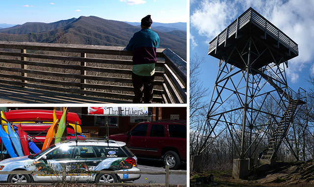
Many beautiful places were brought into the purview of the AT as the result of these protected-land relocations, but, in some ways, it changed the character of the trail forever. This moderately strenuous circuit hike provides several examples of what has been gained. And what has been lost.


The story above is an excerpt from our Sept./Oct. 2014 issue. For the rest of this story and more like it subscribe today, view our digital edition or download our FREE iOS app!

You Might Also Like:

Several bridges help hikers make their way over the stream.

Kentucky’s Bad Branch Falls: A (Fairly) Tame Trek Through the Forest

You’ll know the impressive 60-foot cascade is near when the path turns rugged.
Confederate cannons had a clear shot at the city and river.

Chattanooga’s Lookout Mountain: Spectacular Views and Civil War Echoes

A moderate 3.5-mile walk on Lookout Mountain delivers a healthy dose of delightful scenery and American history.
The boardwalk arches gently over a wetlands area.

Blairsville’s Meeks Park: Wandering a Well-Tended Gem

This bustling North Georgia green space offers nearly 5 miles of well-kept trails, waterfront views and abundant amenities for both recreation and relaxation.
Trails pass through a dense forest and a power line provides a viewpoint.

South Charleston, WV: Rediscovering a Childhood Park

In South Charleston, West Virginia, our intrepid walker returns to an area where he lived for 30 years for a pleasant stroll and an unexpected soapbox derby event.
873a4e6c-42c7-11f0-9375-1248ae80e59d-8

Seneca Adventure Trail

Originally built for a high-school cross country team, the woodsy walk offers an even treadway and delightful doses of nature.
The Cut-Through is a defining feature of Pikeville.

Pikeville, Kentucky: The Real McCoy is Just That

Pikeville, Kentucky, has put itself on the trail-map map with a varied, demanding and rewarding trail.
Downtown Roanoke, VA

Roanoke, Virginia: Mill Mountain and Downtown

The bounty of trails on Roanoke’s own mountain combine with the Roanoke River Greenway and downtown to create a fine walk.
The greenway is nearly level throughout its 8 miles.

Granite City Greenway

Mount Airy, North Carolina’s 8-mile riverside trail is a delight in many contexts, including fishing and jumping in.
The observatory functions after rain and fog lift.

Hanging Rock Raptor Observatory

The veteran and inveterate hiking couple learns anew not to let a bit of rain get in the way of the walk.
The Cool Springs Overlook looks onto the Holly Creek Valley.

Walking Fort Mountain State Park

The expertise and work of the Civilian Conservation Corps is abundantly evident in walking this 4,058-acre park.

CALENDAR OF EVENTS