


The story below is an excerpt from our May/June 2016 issue. For the rest of this story and more like it subscribe today, log in to read our digital edition or download our FREE iOS app. Thank you!
Sometimes there is the urge to go on a weekend hiking trip without having to put in big miles. Without having to huff and puff up steep hills or ford mountain creeks full of chilly waters. You just want a trip that will take you away from the bothers of everyday life, that will let you simply enjoy being in a deep woods.
If that’s what you desire, the Cranberry Wilderness’s southwest corner is for you. The wilderness’s largest portion was designated by Congress in 1983, but the landscape you will be walking through was added in 2009, making it, at more than 47,000 acres, the largest such preserve in West Virginia. Protected from modern-world transgressions, wildlife is varied and abundant. Deer, mink, bobcats, foxes, snowshoe hares, turkeys, grouse and squirrels have all been seen at one time or another.

The outing could be an easy day hike, as there is only one short stretch of steep uphill. However, there are so many great backcountry camping options that I recommend making this an overnighter. You could stay in a three-sided shelter along the Cranberry River, set up a tent beside Lick Branch’s tumbling cascades, or spend the night on a ridgeline below maple and birch boughs. (There is also the overnight option of making base camp at the Cranberry Campground and still doing this as a day hike.)
Begin the outing by leaving the campground, walking around the gate, bypassing the North-South Trail (it will be the return route), and continuing along the forest service road. Although wilderness areas are closed to motorized vehicles and bicycles, FSR76 is on the edge of the wilderness where bicycles, equestrians and hand carts are permitted. I have seen large families pushing multiple wheelbarrows along the road with enough provisions to last for two weeks. Add that anglers come here in significant numbers to take advantage of the Department of Natural Resource stocking the river with trout every week during the warmer months, and the first portion of the hike may feel a bit crowded and harried.
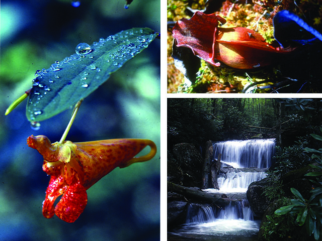
Swimming holes and campsites beckon at .4 mile, Lower Twin Branch flows down the mountainside at .75 mile and the Queer Branch Shelter, at 1.6 miles, has been filled to capacity every time I’ve come this way. (There are some nice tenting spots among patches of jewelweed and viper’s bugloss nearby.)
The river and the possible hustle and bustle of the roadway are left behind when the hike turns left at the three-layered waterfall beside the Lick Branch Trail at 1.9 miles. The pathway ascends steeply at first as it swings away from the creek, but becomes more gradual where it turns left onto an old logging road at 2.5 miles. However, be watching for the left turn off the road that leads the hike back to Lick Branch at 3.1 miles.
The Cranberry Wilderness is a designated sanctuary where black bear hunting is prohibited, so this large expanse of land is one of the best places in the state to possibly catch a glimpse of one—or at least some signs of them being around. Front paw prints are about four inches long and five inches wide with five toes. The back paw print is about seven inches to nine inches long and five inches wide. It almost resembles a human foot print except that the longest toe extends from the middle of the paw. In soft soil it’s often possible to identify claw marks in front of the toes.


