


This short hike provides tastes of history, forest and creatures.
Thousands of people come to the Great Smoky Mountains region every year and never set foot inside the national park. A segment of my family fits that description. They vacation here almost annually, but they are not hikers (nor even walkers). They come to ride the attractions of the area’s amusement parks, shop at the stores, imbibe in meals and sweets that are not available near home and luxuriate in the amenities offered in fashionable resorts.
However, this past year I was able to talk two nephews into an early-morning walk before meeting up with the rest of the family back in town for breakfast. The pathway is certainly not a wilderness route. It goes under the Gatlinburg Bypass and runs close to the Newfound Gap Road for much of the way, but it was my chance to get the boys into the woods.

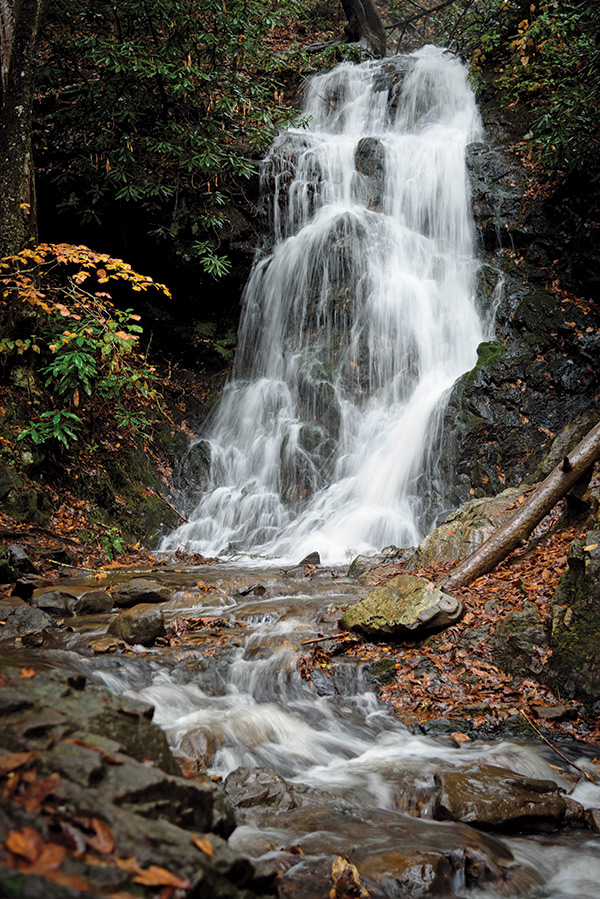
The Gatlinburg Trail starts at the national park’s Sugarlands Visitor Center and within a few hundred yards a short side trail (less than .4 mile roundtrip) leads to Cataract Falls. There had been heavy rains for the last couple of days so the 25-foot falls was putting on a rather impressive display for late summer.
We had breakfast at…
Timbers Log Cabin in Gatlinburg. It was nice to find a non-chain restaurant and the portions were so large that we split some of the entrées in half to share.
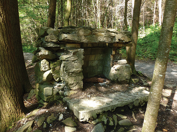
Back on the main route, the sights and sounds of flowing water continued as the trail paralleled the Little Pigeon River’s West Prong all of the way to town. There were some history lessons here, too. A stone chimney and some rock piles are reminders of the past. Although we were walking in what is now a deep woods, much of this area was once open land with acres of corn growing amongst a thriving community of farmsteads, mills, a church, school, post office and more.
A Civilian Conservation Corps camp was also located here after the park was established and, evidently, this bit of America’s past is no longer discussed in schools. I had to explain the CCC to my nephews, describing how this Great Depression program helped transform the country by constructing roads, trails, buildings and other structures that are still in use today.
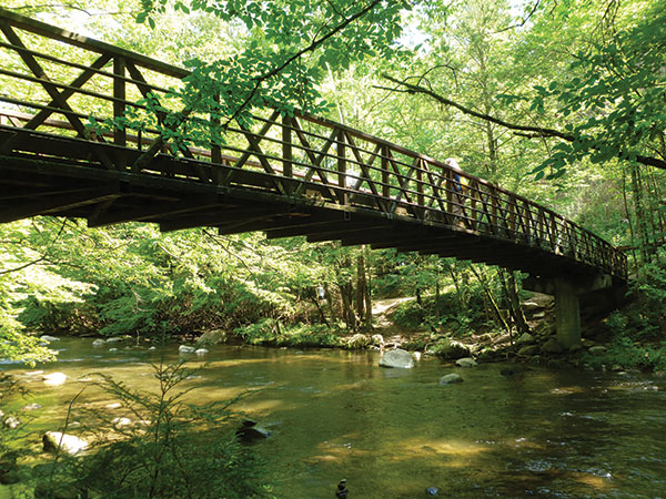
An impressive footbridge crossed the river, providing long views both up and down the stream. A couple of white-tailed deer surprised us just as much as we did them when they burst out of the woods to dash in front of us. A small flock of gobbling turkeys provided entertainment just a few yards before the trail came to an end on the eastern edge of Gatlinburg.
Their first woodland hike must have agreed with the boys. After we were shuttled back to our car at the visitor center, both wanted to hike the 1.2-mile Fighting Creek Nature Trail before returning to town. One remarked, “We saw animals, learned some history, waded in a river and looked at a cool waterfall. Wonder what we’ll see on this trail?”
When You Go
The Walk: An easy two-mile walk beside a scenic stream inside Great Smoky Mountains National Park.
Getting there: Follow US 441 eastward from the center of Gatlinburg for a little more than two miles to the Sugarlands Visitor Center. The Gatlinburg Trail starts here, but finding it is a bit tricky; ask inside the visitor center.
More information: “Hiking Great Smoky Mountains National Park” by Kevin Adams has a short description of the trail.
Find out more about Leonard’s walking and hiking adventures at habitualhiker.com.
The story above appears in our January/February 2020 issue. For more subscribe today or log in to the digital edition with your active digital subscription. Thank you for your support!


