


Appalachian Trail from James River north to Fullers Rocks and back. 7.4 miles.
You could do a whole lot of hikes and then try to pick a top 10, say, but it would be silly, because they’re all great. (Well, that one hot August day down near Pearisburg . . . )

But maybe this one would make the finals anyway. And at least in part because we hadn’t done it for several years, owing to my recollection that The Greatest Day Hiker Of Them All, despite her well- and repeatedly earned title, had griped about the endless switchbacks the last time we’d done it. Which, as I recall, was a hot summer day.
This was not a hot summer day. But maybe the warmest, prettiest day you could find in the middle of November. With the sun good and bright and very little breeze.
The walk starts easily and delightfully enough, paralleling and crossing a pretty creek (Cashaw?) on its way to the James, before sloping up gently through the woods for nearly half the walk.
Then the fun begins. As in the 21 switchbacks that take you up the mountain to Fullers Rocks. The way to attack them, as we practiced this day, is to count them as they get taken, and to exalt in the pleasant temps to undertake them in. And get up on the ridge line and exchange perspectives that it was pretty daggone easy.
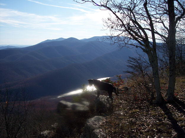
And then spread out lunch to look down on the James, glistening there in the sunshine on its way to the sea. To look eastward and see Lynchburg just before the river turns out of sight. To look out upon Virginia as if flattens out, and to pick out familiar peaks (there’s Apple Orchard Mountain!) in the foreground. And have The Day Hiker fret a little about rock-explorer dog Cookie getting too close to the edge.
All in all, a great walk up and an easy stroll back down.
November 15, 2009


