East Tennessee’s Johnny Molloy has been writing about the Southern Appalachians (and beyond) for more than 30 years. We’re pleased to present a few easy walks-to-falls from his new book on waterfalls.
Pick an outdoor area in the Southern Mountains and Johnny Molloy has been there, done that and written the guidebook about it.
Molloy is the author of some 75 books on hiking, camping, paddling and the outdoors in general. His ties to East Tennessee include a deep fandom for University of Tennessee sports and his marriage to the former Keri Anne Sherwood of Johnson City.
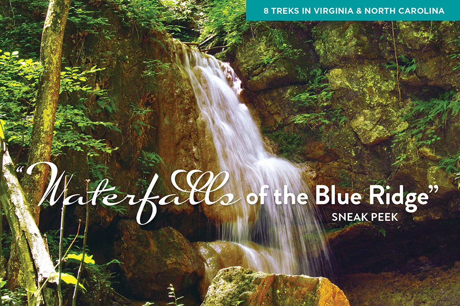
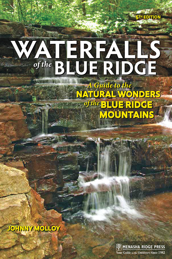
“Waterfalls of the Blue Ridge: A Guide to the Natural Wonders of the Blue Ridge Mountains, 5th Edition” outlines 108 walks to some 140 waterfalls in Virginia and North Carolina.
Each falls presentation provides directions including GPS, along with a detailed description of the walk to the falls. The samples we present here are based on the criteria of being a loop or balloon hike, and being of either easy or moderate in difficulty and length. Captions here are based on information excerpted from Molloy’s text.
The book (Menasha Ridge Press; April 2021; $18.95) is at bookstores, Amazon and other outlets. For more information on the author: johnnymolloy.com
North Carolina Falls
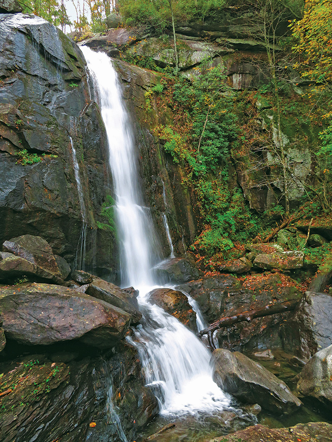
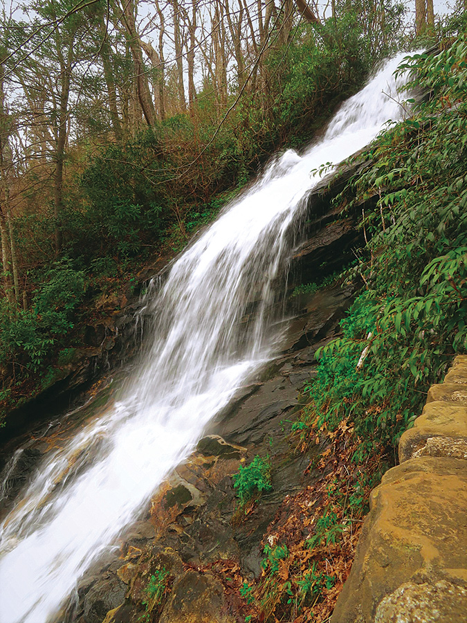
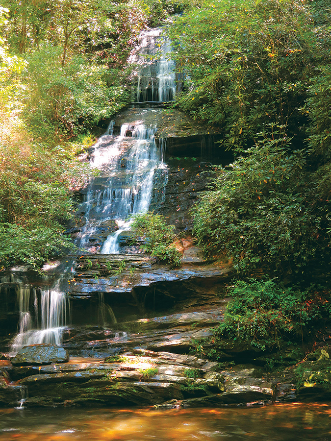
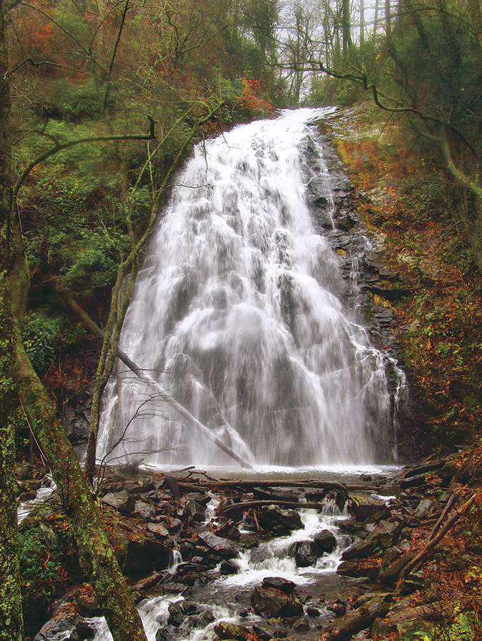
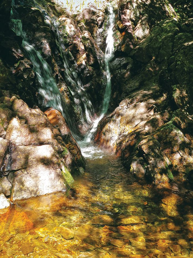
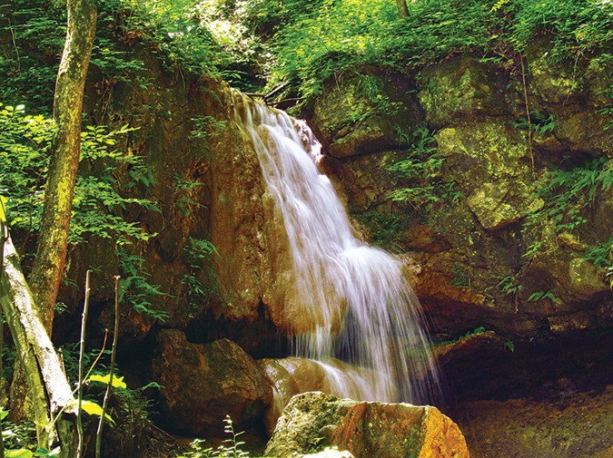
High Shoals Falls and Upper Falls. (2.7-mile loop, moderate). These two falls form a spectacular geologic feature in South Mountains State Park, in Burke County. GPS: 35.602805, -81.627909 Cascades (0.8-mile loop, easy). This 240-foot falls is at E.B. Jeffress Park at Milepost 272.5 of the Blue Ridge Parkway, and the trail offers displays on the flora of the walk. GPS TRAILHEAD COORDINATES 36.249983, -81.456850 Waterfalls of Deep Creek. (2.4-mile loop, easy-moderate). This series of three falls (Tom Branch Falls above) is in Great Smoky Mountains National Park, and the winter and spring seasons offer the best flows and best solitude. GPS: 35.464228, -83.434548 Crabtree Falls. (2.7-mile loop, moderate). This popular spot is at Milepost 338.9 of the Blue Ridge Parkway, where the 70-foot falls draws viewers to the extent that early morning is recommended for visit time. GPS: 35.812541, -82.143360
Virginia Falls
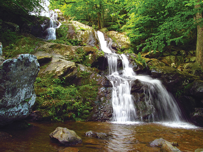
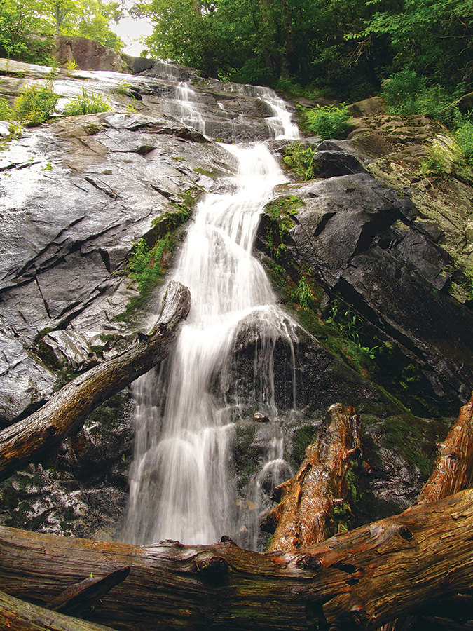
Dark Hollow Falls and Rose River Falls. (4.0-mile loop, moderate). This Shenandoah National Park walk includes “numerous cascades along what is arguably the prettiest steam in the park,” Hogcamp Branch. GPS TRAILHEAD COORDINATES: 38.533567, -78.420783 Fallingwater Cascades. (1.5-mile loop, moderate). This walk is easy and short enough for children and older walkers, and its trailhead is just north of Peaks of Otter, at Blue Ridge Parkway milepost 83.5. GPS: 37.472900, -79.580350 Falls of Cabin Creek. (1.9-mile loop, moderate). These two Grayson Highland State Park falls, near Massie Gap, are among the highest-elevation falls in the state, at above 4,000 feet. GPS: 36.633868, -81.509865 Falls of Falls Ridge Preserve. (0.9-mile balloon, easy). “These falls are the most peculiar in the Old Dominion,” the entry begins. Here, calcium carbonate deposits—travertine—create the rounded stairsteps of the falls. GPS: 37.193111, -80.321417
Ten years after this poll’s inaugural launch, we once again turned to our knowledgeable readers for their picks. The results? A brand-new collection of 71 exceptional Blue Ridge communities that excel at bringing big smiles to the faces of both residents and visitors.
Our longtime contributing editor knows Great Smoky Mountains National Park like the back of her hand. Drawing inspiration from countless visits over the years, she shares some of her favorite spots to explore during the warm months, plus insider tips for spotting wildlife, discovering waterfalls, finding the best family-friendly experiences in the park—and more!
More than a century after the 1921 West Virginia Miners’ March that ended with
the Battle of Blair Mountain, the story is being told in new and unforgettable ways.
On July 4, 1776, a new nation was born. In honor of this historic day, we explore the forts, battlefields, museums, trails, and more that trace the Patriots’ journey to freedom in the Blue Ridge Mountains.


")


